NEWS CENTER
How to Select a Radar Water Level Sensor for River and Hydrological Monitoring: Beam Angle, Communication and Installation Guide
Huachuang measurement and control Huachuang measurement and Control Technology Co., Ltd 2026-09-24 13:49
In rivers, lakes, reservoirs, dams, irrigation channels and urban flood-control drainage systems, water level measurement operates under very different conditions from enclosed industrial storage tanks. Hydrological monitoring stations are typically located in remote or unattended outdoor areas where fixed AC power and wired industrial networks are unavailable. Many stations rely entirely on solar panels or battery power. Sensors remain exposed year-round to outdoor sunlight, rain, extreme temperatures, humidity and wind. The open water surface may experience waves, turbulence, floating debris or aquatic vegetation. Furthermore, sensors are usually mounted on cantilever arms, bridge sides or standalone poles. Although free from closed tank wall constraints, the radar beam can easily intercept bridge piers, riverbank slopes, shoreline vegetation or structural supports. Therefore, water level sensor selection must evaluate power consumption, communication interfaces, ingress protection, beam focus and mounting bracket compatibility together—not measuring range alone.
An improper selection can cause power failure during continuous overcast days, intermittent telemetry transmission, false level readings caused by side reflections from shoreline slopes, or internal moisture ingress under heavy rain. Before selecting an instrument for water conservancy projects, engineers should define the maximum water level variation between dry and flood seasons, the vertical clearance between the mounting bracket and the water surface, field power supply availability (solar, battery, or mains), remote telemetry unit (RTU) interface requirements, and the physical profile of the channel and banks. Incorporating accuracy, range margin, power demand and data interfaces into an integrated selection review ensures reliable, continuous operation at unattended stations.
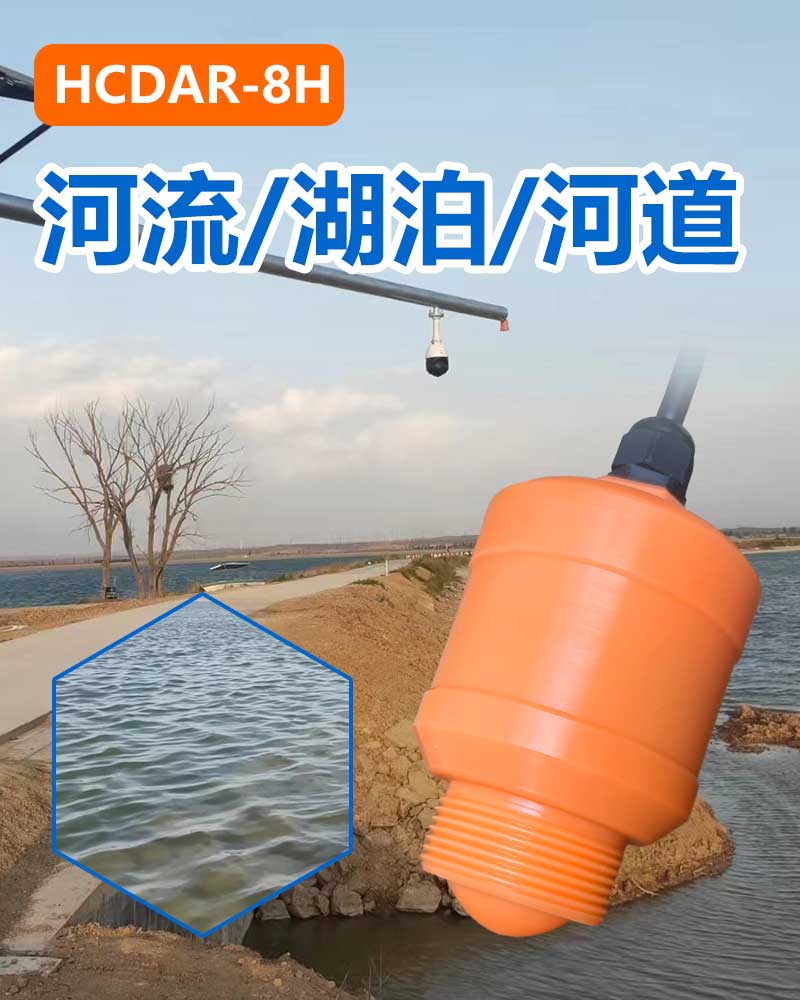
HCCK HCDAR-8H is designed for unattended water level monitoring in lakes, dams, open channels and natural rivers. It provides a measuring range of 0–30 m with an accuracy of ±3 mm, utilizing an integrated lens antenna with a 6° beam angle. Operating on 76–81 GHz FMCW (Frequency Modulated Continuous Wave) millimeter-wave technology, the sensor emits linear frequency-modulated microwave signals and receives reflections from the water surface. The distance is calculated from the beat frequency and FFT signal processing. The 6° concentrated beam focuses microwave energy onto the target water stream in both open reservoirs and narrow canals, minimizing unwanted side reflections from bridge piers, embankment slopes, floating vegetation or mounting poles. The ±3 mm accuracy meets national hydrological and flood warning requirements for millimeter-level water level tracking.
For outdoor environmental durability and system integration, HCDAR-8H features an operating temperature range of −40 to 85°C and an IP67 protection rating. Its compact and lightweight housing supports bracket mounting and threaded process connections, enabling straightforward installation on cantilever poles, bridge railings or tower structures. In terms of communication, the instrument provides two-wire (4–20) mA HART, RS485 MODBUS-RTU, LoRa wireless communication, and Bluetooth wireless debugging. For integration with low-power hydrological RTUs, solar telemetry stations, or cloud monitoring platforms, RS485 MODBUS-RTU and LoRa minimize field wiring and total system power consumption. The Bluetooth interface enables field technicians to perform parameter configuration and diagnostics wirelessly via mobile devices without opening the protective housing.
Mounting location selection directly determines measurement reliability. The radar water level sensor should be installed over a section where water flow is relatively smooth and accurately represents the river or reservoir stage, avoiding hydraulic drop zones, turbulent vortices, direct outfall discharges, and stagnant corners with accumulated debris. The antenna face must remain level and perpendicular to the water surface, securely locked via the mounting bracket or thread to prevent sensor tilting caused by wind load or structural vibration. A sufficient horizontal clearance must be maintained from bridge piers and embankment slopes, ensuring that no poles, tree branches, revetment stones, or staff gauges obstruct the 6° conical beam. For high-bridge or steep-bank installations near the 30 m range limit, engineers should verify the beam footprint radius at the lowest water level to prevent bank reflections from being misidentified as the water surface.
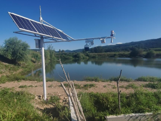
During commissioning, technicians should first configure the mounting height, benchmark zero elevation, full measuring span, and damping filter time via the communication interface or mobile app. Signal stability should be recorded under calm dry-season conditions, windy wave conditions, and rainfall surge events, verifying consistency between the radar display and the physical staff gauge reading. If the reading becomes fixed, fluctuates unexpectedly, or drops, technicians should inspect bracket rigidity, check for newly grown branches or floating objects in the beam path, confirm power supply voltage stability, and verify that the RS485 address and baud rate match the RTU data logger. By providing HCCK with the monitoring scenario, maximum level range, mounting height, bracket structure, power configuration, and data acquisition interface, technical teams can determine the optimal HCDAR-8H configuration and installation design for the project.
For professional support, visit our Website at www.hhcck.cn/, contact our team via WhatsApp: +86 195 3225 4537, or Email: sales@hhcck.com.


South of Puhui Street, west of Guangsheng East Road, High tech Zone, Fengnan District, Tangshan City, Hebei Province





Technical support:

Tips
Submitted successfully
Back Index